
Dominion Land Survey
In 1870, at the same time settlers were pouring into the American west, the newly formed Dominion of Canada purchased Rupert’s Land from the Hudson’s Bay Company through the Deed of Surrender. Fearing that the American would encroach onto Canadian land the government in order to affirm sovereignty endeavoured to settle the west with immigrant farmers and establish an agricultural economy. To entice British Columbia to enter confederation they had already promised a railroad joining them to the East and now they began actively recruiting farm immigrants from Europe and eastern Canada. The Canadian Pacific Railroad whose construction began in 1881 would greatly help the settling of the west, but they also had to partition the land into plots suitable for agriculture and other uses. Thus, the Dominion Land Survey.
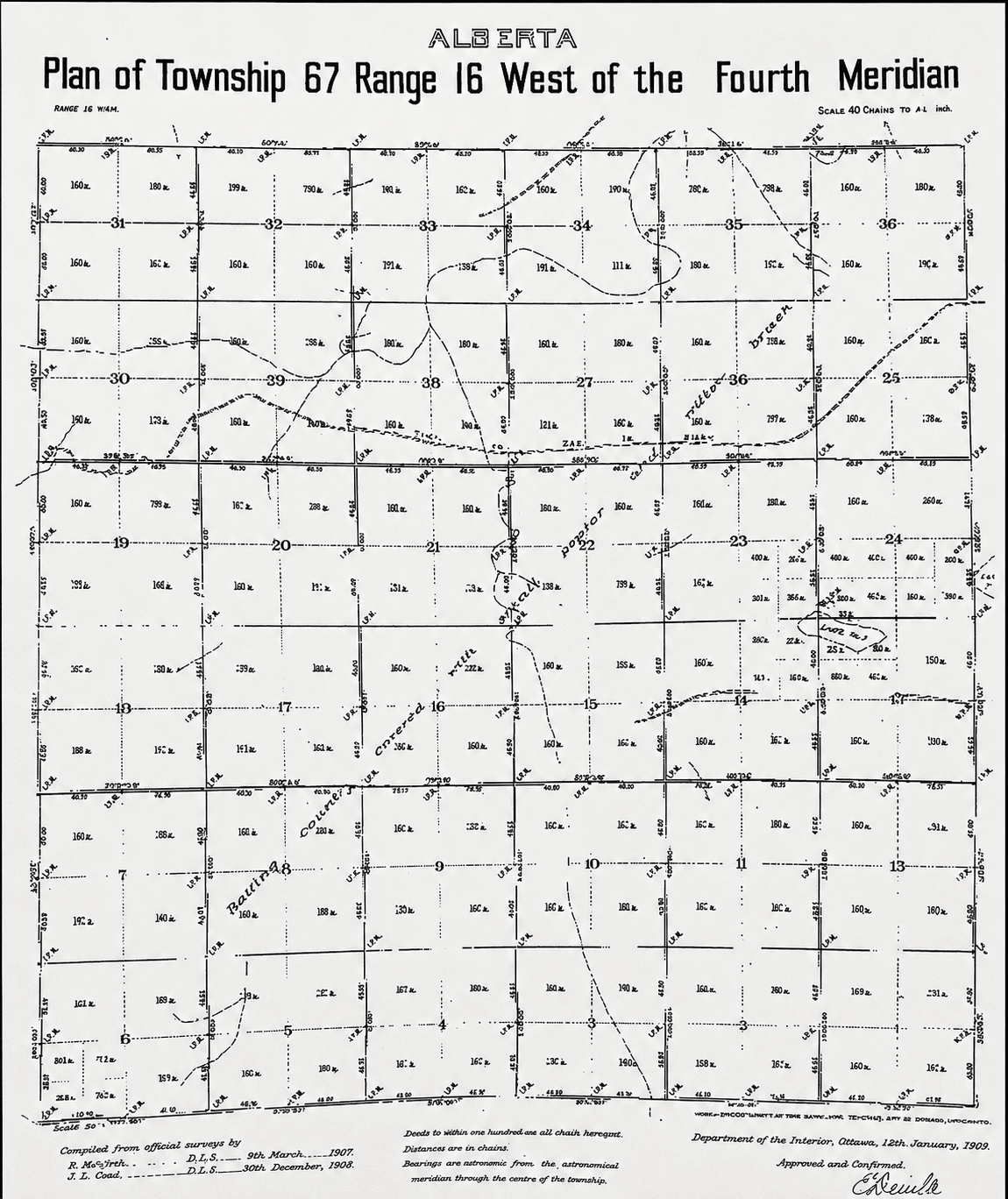
The Dominion Land Survey, the largest survey grid in the world, is the method used to divide a large part of Western Canada into Townships six miles square, which were further divided into thirty-six square mile sections then into quarter sections of 160 acres. The quarter sections were to be claimed as homesteads by the settlers. Excluded from the survey were federal parks, weapon ranges and First Nation reserves. Around Lac La Biche the Métis maintained their long narrow lake lots which followed the shore for 64 kilometres around the lake including the west end where Plamondon now stands.
The surveying was divided into five basic surveys each slightly different from the others. The first (1871 to 1879) covers part of southern Manitoba and a little of Saskatchewan. The second which is the smallest covers a small part of Saskatchewan. The third system begun in 1881 is the largest. It covers large parts of Alberta and Saskatchewan. The fourth and fifth systems were used in some township of British Columbia.
The survey system marked the end of the nomadic way of life of the First Nations and Métis in the west, and they were not happy with it. It precipitated events leading up to the Red River Rebellion in 1869-1870 and subsequent North West Rebellion in 1885. The Métis wanted to maintain their religion, land rights, and culture but the Canadian Government acted as though nobody was there.
The Dominion Lands Act in 1872 allowed for land to be granted to individuals, colonization companies, the Hudson’s Bay Company, railroads and municipalities while setting aside land for First Nations and National Parks. Métis land was organized outside this system using the scrip system. The Act stated who was eligible for a 160-acre homestead and what they had to do to get a patent. The policy changed over time but basically a ten-dollar administration fee had to be paid, the homesteader had to build a home within three years, live in it for at least six months every year, clear the land for farming and cultivate a certain area annually.
Two hundred million acres were surveyed and more than one and quarter million homesteads were created by the Dominion Land Survey. It was completed in 1930.
References
- “Dominion Land Survey” Wikipedia. May 27, 2026. https://en.wikipedia.org/wiki/Dominion-Land-Survey
- “Alberta Geomatics Historical Society” Wikipedia. June 24, 2026. https://albertalandsurveyhistory.ca/featured-articles/the-dominion-land-survey-system/